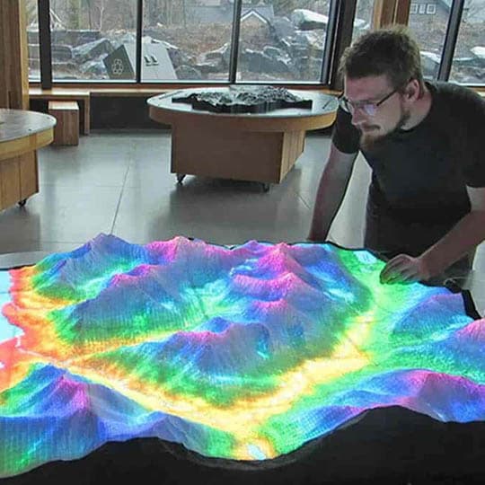
3D Maps
Environmental Awareness Topographic Display
2021
3D Maps
The topographic display is entirely new type of visualization system, invented and developed by myself and Metrographics Art & Design. This map provides an animated visual representation of the dynamic landscape through internal illumination. It is controlled through a touchscreen user interface and provides information about several types of environmental […]
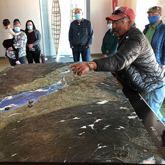
Waterton Lakes National Park
2021
3D Maps
This map of Waterton Lakes is on exhibit at the new visitor centre. It serves to orient visitors to the park, present them with information about the location, and facilitate their trip planning and daily activities. To accomplish this, it displays key elements for both Parks Canada and the Blackfoot […]
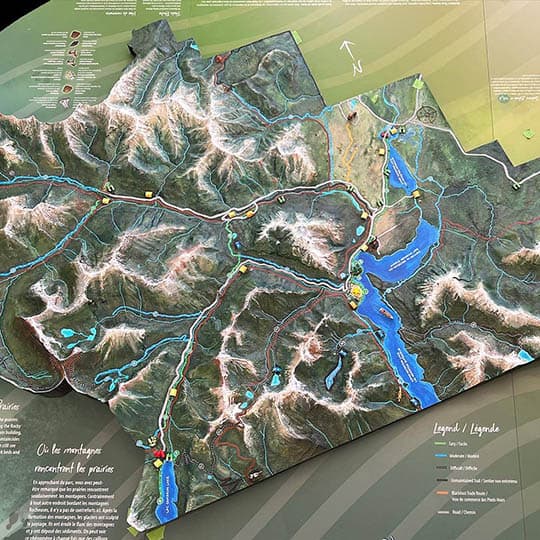
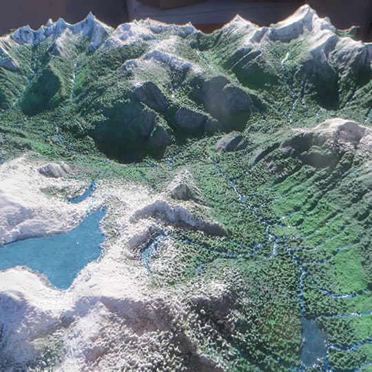
The Eldred Valley
2022
3D Maps
This valley is deep in the wilderness of the qathet region, about 50km North of Powell River BC. The Eldred is home to magnificent alpine regions, frozen lakes, deep forests and beautiful rivers and streams. In the centre is the Colin Arthur Dionne Memorial Climbers Camp, surrounded by vast and […]
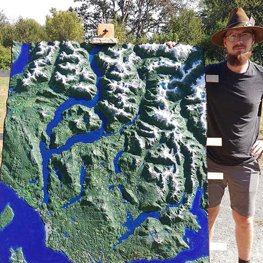
Qathet Peninsula
2022
3D Maps
The qathet region lies between Toba and Jervis inlets, on the West coast North of Vancouver. Qathet includes the traditional territory of the Tla’amin and Sechelt peoples, and is the location of the settlements of Lund, Tsi-sho-sum, Powell River, and Saltery Bay. This region is a vast landscape where the […]
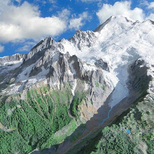
Mount Baker
2023
3D Maps
Mount Baker has often been visible from on my horizon. This volcanic mountain is truly a dramatic place, uplifted rock into towering peaks, shaped by glaciers sculpting the surface. This piece was created to test new mapmaking techniques, and simply because it felt like it was a place worth geting […]