3D Maps
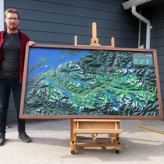


Southern Gulf Islands
2021
3D Maps
This combined topographic/bathymetric map was created for conservancy group IMERSS. The featured location is the Southern Gulf Islands, an area between Vancouver Island and Vancouver. This region is an area of intense geologic pressure, with compression and folding giving rise to an archipelago of elongated islands. These islands, submarine topographies, […]
